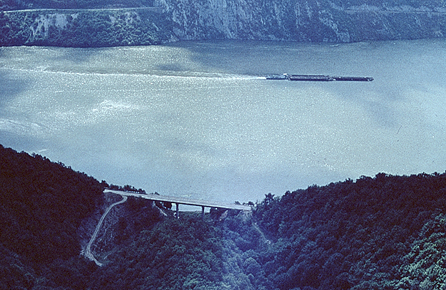
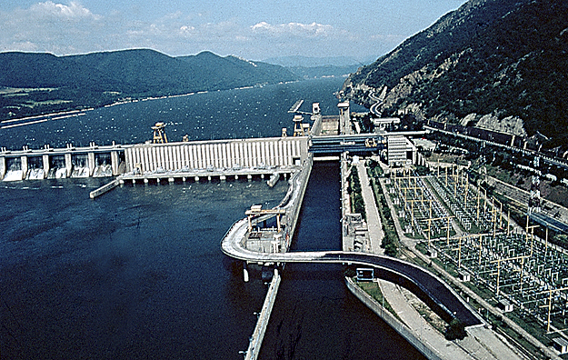
station and the dam within
the hydro-power and navigation system
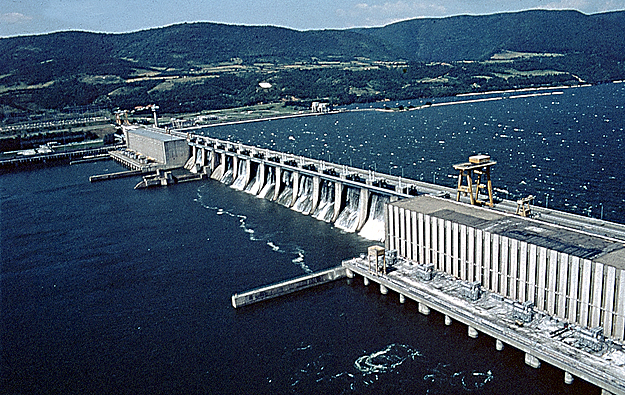
"Portile de Fier I" (Iron Gate I)
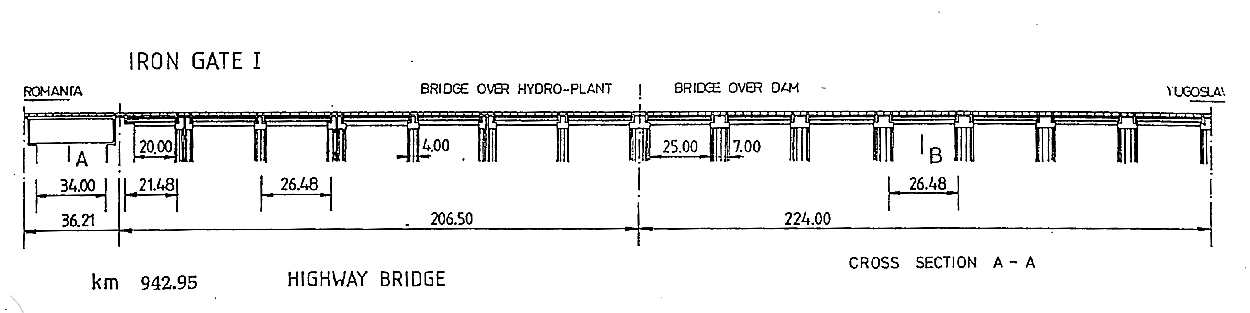
| Iron Gate I |
| Location and name of the bridge: | |||
|
|
|||
| Name(s) of the bridge: | Bridge over
the hydro-power station and the dam within the hydro-power and navigation system "Portile de Fier I" (Iron Gate I) |
||
| Distance: | 942+(600-900) km | ||
| Country: | Yugoslavia-Romania | ||
| City/town | Hydro-power and navigation system "Portile de Fier I" | ||
| Year of building - completion: | 1972 | ||
| Span lengths: | |||
| Span lengths: | 36.21 + 21.48 + 13 * 26.48 for the Romanian section |
||
| Designer: | Institute for Road, Water and Air Transport (bridge over the dam and hydro-power station), 1968 Hydrotechnical Design Institute (over the lock), 1967 |
||
| Main contractor: | Hydrotechnical Construction Enterprise | ||
| Location and name of the bridge: | |||
| Name(s) of the bridge: | Bridge over
the Djerdjap I hydro-power and navigation system (Yugoslavian part) |
||
| Distance: | 942+950 km | ||
| Country: | Yugoslavia-Romania | ||
| City/town | Kladovo-Drobeta Turnu Severin | ||
| Route: | M-25 transition Yu-Ro | ||
| Year of building - completion: | 1972 | ||
| Span lengths: | |||
| Span lengths: | 36 + 3 × 5 + 13 × 25 m (free spaces) | ||
| Flood plain bridges: | |||
| Main bridge over streambed: | |||
| Symmetrical viaducts of: | |||
| Total length: | |||
| Roadway widths: | 9,1 m, total width: 11.2 m | ||
| Designer: | Energoprojekt-Hidroinzenjering, Beograd Mirjana Tucovic |
||
| Main contractor: | Energoprojekt-Izgradnja, Beograd | ||
| Owner of the bridge: | Hydropower Plant Djerdap | ||